Kancha Gachibowli Forest Change Analysis
Between March 30, 2025, and April 3, 2025, a deforestation drive was undertaken in Kancha Gachibowli Forest. We have conducted a quick assessment to map the extent of deforestation and land area that was disturbed in those four days.
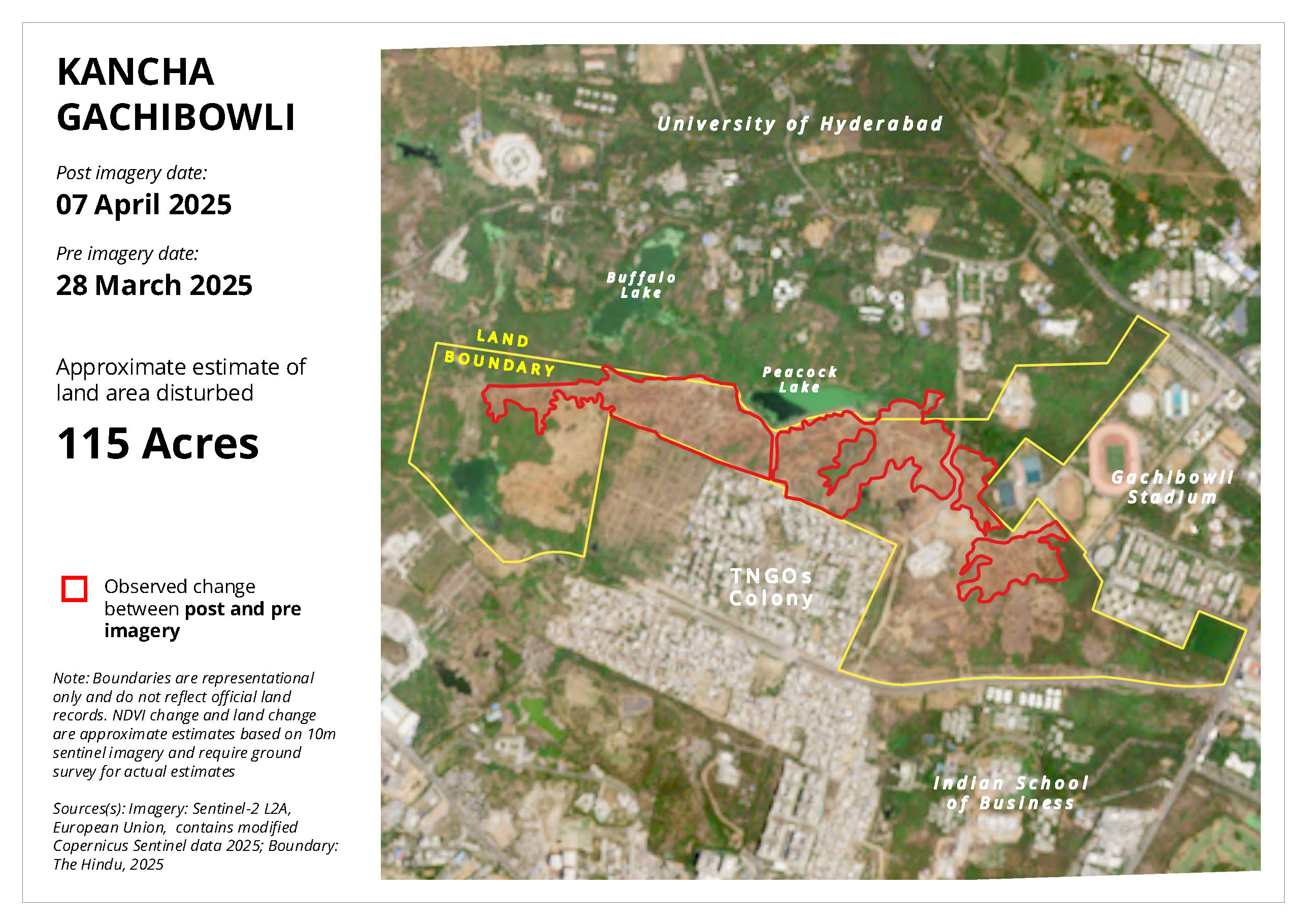
This analysis focuses on the observed changes in the Kancha Gachibowli area between late March and early April 2025, based on 10m Sentinel-2 satellite imagery. Satellite imagery from March 28, 2025 (pre-deforestation) and April 7, 2025 (post-deforestation) was compared to assess the extent of tree cover loss and land disturbance. The analysis estimates an approximate green cover loss of 102 acres within the identified boundary, based on NDVI (Normalized Difference Vegetation Index) changes, and an overall land disturbance of about 115 acres, based on observed surface changes.
Using the location sketch provided in The Hindu (accessed on 8 April 2025), we georeferenced the image and digitized the boundary for reference purposes.
Before and After Imagery
The images below provide a visual comparison of the Kancha Gachibowli area before and after the observed changes, including an illustration of green cover loss and land disturbance.
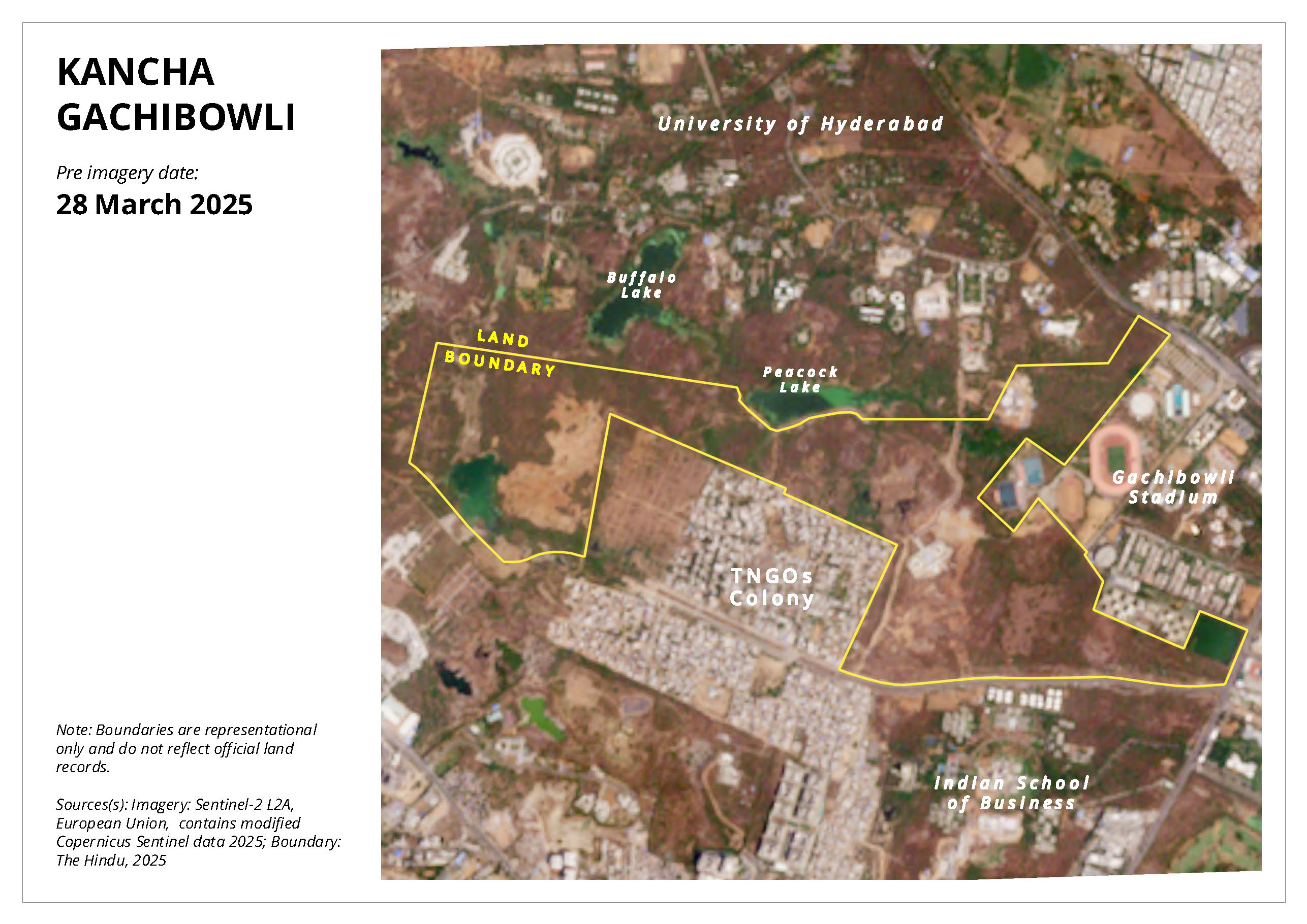
Pre-Imagery: Satellite view of Kancha Gachibowli on 28 March 2025.
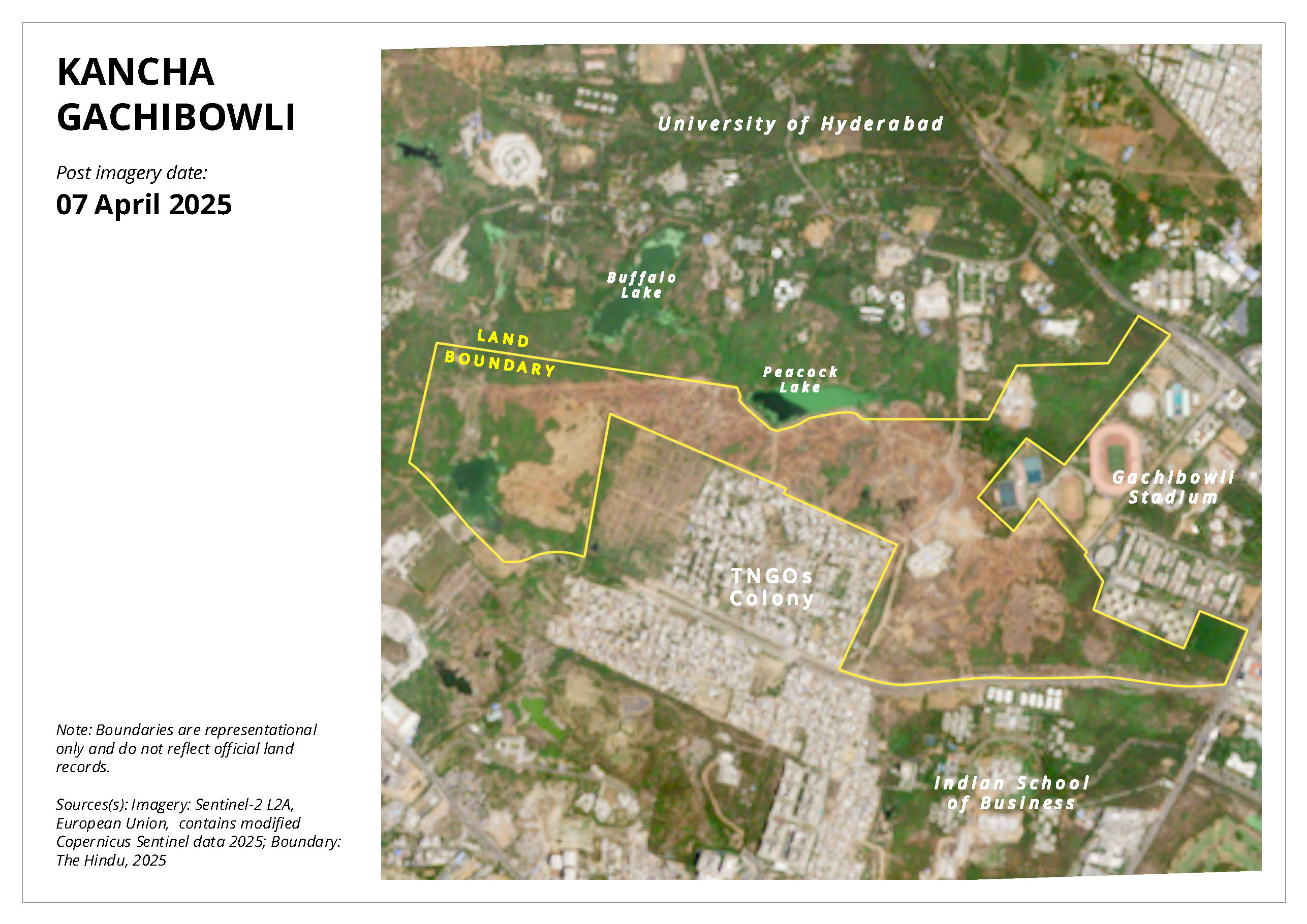
Post-Imagery: Satellite view of Kancha Gachibowli on 07 April 2025.
NDVI Change: Illustrates the approximate green cover loss of 102 Acres within the boundary, derived from NDVI analysis.

Land Disturbance: Shows the approximate land area disturbed, estimated at 115 Acres, based on observed changes.
Use arrows or squares to navigate
Explore Interactive Layers
Toggle before and after satellite imagery and the change layers on the left panel.
This assessment was conducted for An Ecological Heritage Compilation and Report by Dr. Joseph Joby, University of Hyderabad. We worked in close coordination with Arun Vasireddy, who was part of the team that compiled the report.